The Underwater Geology Of The Hawaii Islands Is Just Astonishing
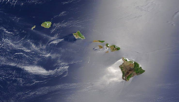
The Pacific Plate is moving northwestward at a significant rate – several centimeters per year. This constant plate movement over a local volcanic “hot spot,” or plume, has produced a chain of volcanic islands, one after another in assembly-line fashion. They go (really) by the name Hawaii.
Situated near the middle of the "Pacific Plate" on top of a "hot spot", the Hawaiian Islands (also known as the Hawaiian archipelago) consist of eight major islands and 124 islets stretching from the Big Island of Hawaii along a northwest line for 1,500 miles toward Japan and the Aleutian Islands of Alaska. In total, the islands cover an area of 6,459 square miles. The largest landmass in the Hawaiian island chain is currently the Big Island (yes, that might change over time), followed by the other seven major islands at the eastern end of the chain, from west to east: Ni'ihau, Kaua'i, Oahu, Molokai, Lanai, Kahoolawe, and Maui.


