


Storm Ashley Unleashes Fury Across Britain
Britain is currently facing the brunt of Storm Ashley, which is delivering fierce 80mph winds and relentless downpours. The Met Office has issued multiple weather alerts and dozens of flood warnings as the nation braces for the first named storm of the season, which poses a significant risk of injuries and danger to life.
A yellow wind warning was activated at 3 am for all of Scotland and Northern Ireland, along with parts of north-west England and Wales, remaining in effect until midnight. Additionally, an amber warning for the north-west of Scotland is active from 9 am to midnight, cautioning that large waves and beach debris could pose risks to coastal roads, properties, and public safety.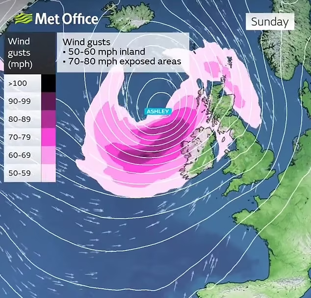
Images are emerging of thrill-seekers defying warnings, walking along sea walls as massive waves crash nearby. Meteorologist Dan Stroud emphasized the severe gales expected throughout the day, coinciding with high spring tides that could generate exceptionally large waves.
The northern regions of Scotland will remain under a yellow wind warning from midnight until 9 am on Monday. Further south, the Met Office has also issued a yellow warning for south-west England and South Wales, effective until midday today, predicting travel disruptions due to flooding and potential power supply interruptions.
Stroud noted that strong, gale-force winds are anticipated to continue into Monday morning, which may lead to fallen debris and downed trees affecting Monday morning commutes. Road users in Scotland are advised to avoid unnecessary travel, while the annual Great South Run in Portsmouth, Hampshire, has been canceled for safety reasons.
Police Scotland has urged motorists to prepare adequately, ensuring their vehicles are roadworthy, with proper fuel and tire conditions, and to keep mobile phones charged for emergencies. Travelers are warned of significant disruptions on the roads, while public transport services may also be impacted.
Many weekend plans have been upended due to the severe weather, with travel services severely limited and public parks closed. Dublin Airport has canceled a small number of flights, advising passengers to check with their airlines for updates.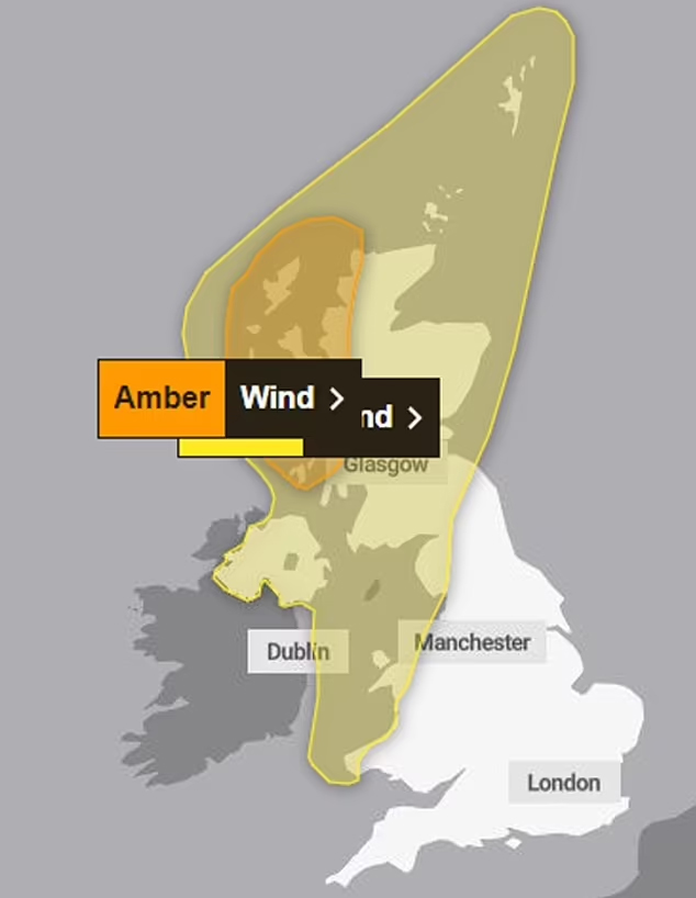
ScotRail announced that trains in the west and north Highlands will operate under precautionary speed restrictions from 4 pm on Sunday until Monday morning, with similar restrictions implemented on routes between Perth and Inverness from 6 pm.
Ferry operator CalMac has canceled many services on the west coast of Scotland today, with more disruptions likely. In Armagh City, Banbridge, and Craigavon, parks and open spaces have been closed until necessary inspections can ensure safety.
The highly anticipated Enchanted Forest event in Pitlochry, Perthshire, has also been canceled for Sunday due to safety concerns for attendees and staff.
The Met Office predicts a day filled with high winds and heavy rain across the UK, with storm-force winds hitting the north-west. Although rain will transition eastward later in the day, forecasters expect some sunny spells in England and Wales by afternoon.
According to meteorologist Ellie Glaisyer, western Scotland could experience gusts of 70-80mph during the afternoon. Winds are projected to ease by Monday, with rain expected to move into the southeast, while the north will remain windy for much of the week.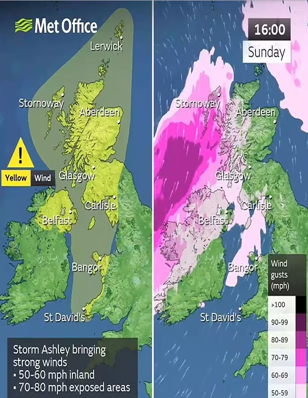
As of Sunday morning, the Environment Agency reported 41 active flood warnings indicating that flooding is anticipated, along with 132 flood alerts suggesting that flooding is possible. Flood warnings are in place for several areas, including the River Severn, south Cornwall coast, and the Wye Estuary.
Natural Resources Wales reported three flood warnings and 13 alerts, while the Scottish Environment Protection Agency issued 16 flood warnings and 17 alerts. Dramatic footage of the storm is surfacing on social media, showcasing colossal waves in Sennen, Cornwall, and turbulent waters on the typically calm Loch Indaal, Scotland.
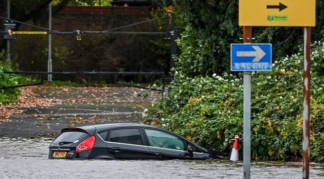
Disturbing images from Worcester depict areas completely submerged, with spectator stands at Worcester County Cricket Club half underwater and parked cars inundated up to their wing mirrors. Streets near the iconic Worcester Cathedral are also flooded.

An Environment Agency spokesperson stated that river levels are rising at the Worcester (Barbourne) gauge due to heavy rainfall, leading to expected flooding of properties, roads, and farmland this morning. With further rain forecasted over the next 24 hours, river levels are expected to remain elevated.
Emergency response teams are actively monitoring the situation in collaboration with local authorities, advising residents to move belongings to safety.


COMMENTS